My first visit to waynad was in 1991 as a carpenter.About 2 years I laboured various places ,there.Attamala,Meppadi,Kakkavayal,Kolavayal,Muttil,Kalpetta...so many places.After then i have visited Wayanad so many times .

Wayanad District in the north-east of Kerala,was formed on November 1, 1980 as the 12th district by carving out areas from Kozhikode and Kannur districts. Kalpetta is the district headquarters as well as the only municipal town in the district. The region was known as Mayakshetra (Maya's land) in the earliest records. Mayakshetra evolved into Mayanad and finally to Wayanad. The Folk etymology of the word says it is a combination of Vayal (paddy field) and Naad (land), making it 'The Land of Paddy Fields'. There are many indigenous tribals(kurichya,Paniya,Adiya,..etc) in this area. It is set high on the Western Ghats with altitudes ranging from 700 to 2100 m.

Jain temple Wayanad is located near Sulthan Bathery. Jain temple Wayanad is also known by the name Ananthanatha swami temple. Ananthanatha swami temple is located near Kalpetta at a distance of six Km from Kalpetta. This Jain temple Wayanad is generally referred to as Tippu’s fort. There is an interesting reason behind this name being given to Ananthanatha swami temple. King Tippusultan stored his ammunition in this fort during his reign. That is why this place is called Tippu’s fort. Another name given to this Jain temple is Sultan’s battery.
Jain temple Wayanad is known to be constructed in the thirteenth century. It is sad to note that the beautiful pillars of Ananthanatha swami temple are ruined due to several reasons.
The inner portion of the temple and the sanctum sanctorium are very quiet and serene. You should visit this temple to enjoy that tranquility and view the excellent architecture involved in its construction.

Kuruvadweep (Kuruva Island) is a 950-acre (3.8 km2) protected river delta on the Kabini River in the Wayanad district,Kerala, India.This island of dense and evergreen forest is uninhabited and hence a home to rare kinds of flora and fauna. Kuruva Island is 17km east of Mananthavady and 40 km northwest of sulthanbatheri
.JPG)
.jpg) The Muthanga Wildlife Sanctuary is located over an area of 344.44 square kilometers and is home to wildlife such as Gaur, sloth bears, sambhar, elephants, reptiles, tigers, spotted deer, monkeys, panthers, jungle cats, civet cats, wild dogs, bison, lizards, bears, wild pigs, leopards,lion-tailed macaque and other animals.
The Muthanga Wildlife Sanctuary is located over an area of 344.44 square kilometers and is home to wildlife such as Gaur, sloth bears, sambhar, elephants, reptiles, tigers, spotted deer, monkeys, panthers, jungle cats, civet cats, wild dogs, bison, lizards, bears, wild pigs, leopards,lion-tailed macaque and other animals..jpg)
.jpg)
.JPG)
.jpg)
.jpg) |
| way to Pakshipaathaalam behind
Brahmagiri, is a mountain range in the Western Ghats of south India. It is situated on the border between Kodagu district in Karnataka state in the north and Wayanad district of Kerala state on the south . Brahmagiri Hill, at 1608 m height, is a scenic tourist attraction .Brahmagiri can be reached by a trek from Mananthavady (29 km east) or from Kutta. From Karnataka side, trek to Brahmagiri from Irupu Falls is 9 km and to Munikal Caves is 7 km. Trekkers need to seek the permission of Range Forest Officer at Srimangala. Brahmagiri is about 11 km from Tirunelli.
|
+copy.jpg)
 |
| Brahmagiri |


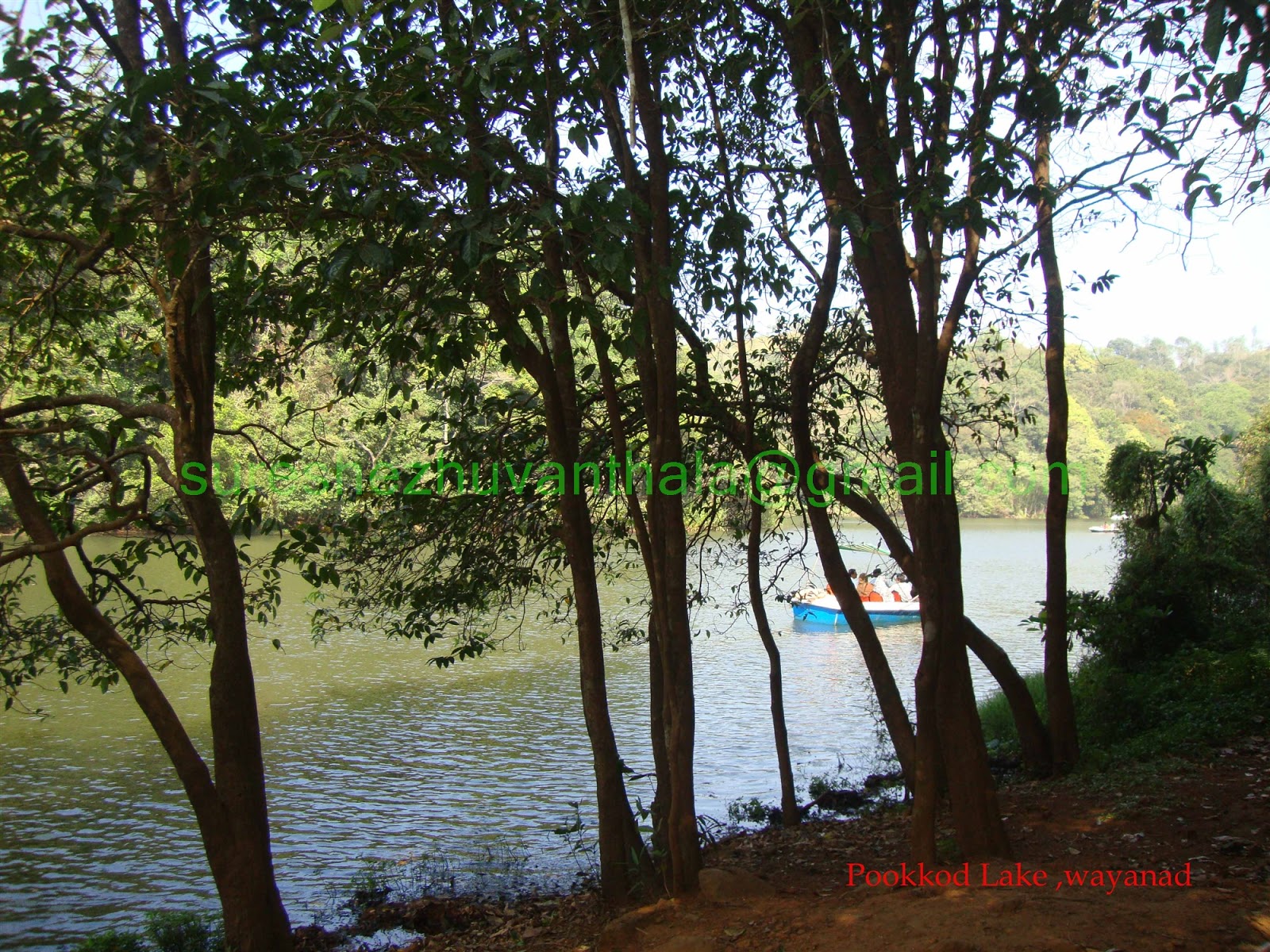
Pookode Lake is a scenic freshwater lake . The lake is surrounded by forests, andboating is allowed. Recent commercial modernisations have removed some of its wild charm. Panamaram, the rivulet which ultimately becomes Kabani River, originates from the Pookode lake. It is spread across an area of 8.5 hectares and with a maximum depth of 6.5 metres.
.jpg)
No comments:
Post a Comment