.JPG)
There are so many destinations to visit Munnar.3 times I visited
munnar.Meesappulimala(2008 December & 2010 December),Anamudi shola
National
park,Vattavada,Kanthalloor,Marayoor,Chinnar,Rajamala,Mattupetty(2012)
are the places which i have seen.
.JPG)
Anamudi Shola National Park represents one of the largest shola forest
ecosystem in the Country with unique biodiversity and climate. The National
Park consists of three pristine shola reserve forests viz., Mannavan Shola,
Pullaradi shola, Idivara Shola which were part of the erstwhile Marayoor Range
of Munnar Division. These forests are totally free from human habitations
within its boundaries. These forms the catchment of streams, which enriches the
east flowing river Pambar. The headquarters of the Park is at Munnar 40 km away
from the National Park.
The NP is located in the Devikulam Taluk of Idukki district at an altitude of 1600 m to 2400 m. It is closely to the Munnar hill station (40 km). The National Park is accessible from Kochi (160 km) and Coimbatore (150 km). The nearest railway station is at Aluva (150 km) in Kerala and Pollachi (100 km) in Tamil Nadu. The nearest town is at Munnar.
Though the notified extent of the NP is 7.50 sq.km the actual area is 42.68 sq.km. as per Survey of India Topo sheet . The climate is cool during most of the year with the temperature range between 9.5oC (December) to 30oC (April). Average annual rainfall range between 2000 to 2500 mm.
The forest is with continuous canopy interspersed with emerging grasslands which is frequented with Strobilanthus kunthianus(Neela kkurinji). Mostly comprises Southern sub tropical hill forests, Southern montane wet temperate forests towards the top and moist deciduous forests. Average height of the forest is 20-25 m at lower elevation. The bark of the trees are covered with lichens, mosses and climbers. The forests are interspersed with montane grasslands.
62 species of trees, 174 species of herbs and shrubs and 39 species of climbers are recorded from here. Among fauna, 100 species of butterflies and 232 species of moths belonging to 36 different families are recorded from here. 76 species of birds are also recorded from here. Tiger, Elephant, Gaur, Leopard, Sambar deer, Wild boar, Nilgiri langur and Giant squirrel are the common mammals seen here.
The National Park represents a unique ecosystem of Shola forests noted for vide presence of tree ferns. It is rich in term of biodiversity and has a high conservation value in term of geo-morphology and hydrology. These forests with adjoining forest areas form a vast stretch of forest cover in the very fragile high range ecosystem.
Many of the species noted here are endemic and some are in threatened category. Parantica nilgiriensis, a RET listed species of butterfly is widely noted here. The shola forest of this National Park forms the catchment of east flowing river ‘Pambar’ and many perennial streams originates from this forests. Muthuvan is the only tribe residing within the limit of the Sanctuary.
The NP is located in the Devikulam Taluk of Idukki district at an altitude of 1600 m to 2400 m. It is closely to the Munnar hill station (40 km). The National Park is accessible from Kochi (160 km) and Coimbatore (150 km). The nearest railway station is at Aluva (150 km) in Kerala and Pollachi (100 km) in Tamil Nadu. The nearest town is at Munnar.
Though the notified extent of the NP is 7.50 sq.km the actual area is 42.68 sq.km. as per Survey of India Topo sheet . The climate is cool during most of the year with the temperature range between 9.5oC (December) to 30oC (April). Average annual rainfall range between 2000 to 2500 mm.
The forest is with continuous canopy interspersed with emerging grasslands which is frequented with Strobilanthus kunthianus(Neela kkurinji). Mostly comprises Southern sub tropical hill forests, Southern montane wet temperate forests towards the top and moist deciduous forests. Average height of the forest is 20-25 m at lower elevation. The bark of the trees are covered with lichens, mosses and climbers. The forests are interspersed with montane grasslands.
62 species of trees, 174 species of herbs and shrubs and 39 species of climbers are recorded from here. Among fauna, 100 species of butterflies and 232 species of moths belonging to 36 different families are recorded from here. 76 species of birds are also recorded from here. Tiger, Elephant, Gaur, Leopard, Sambar deer, Wild boar, Nilgiri langur and Giant squirrel are the common mammals seen here.
The National Park represents a unique ecosystem of Shola forests noted for vide presence of tree ferns. It is rich in term of biodiversity and has a high conservation value in term of geo-morphology and hydrology. These forests with adjoining forest areas form a vast stretch of forest cover in the very fragile high range ecosystem.
Many of the species noted here are endemic and some are in threatened category. Parantica nilgiriensis, a RET listed species of butterfly is widely noted here. The shola forest of this National Park forms the catchment of east flowing river ‘Pambar’ and many perennial streams originates from this forests. Muthuvan is the only tribe residing within the limit of the Sanctuary.
.JPG)
.JPG)

The Chinnar Wildlife Sanctuary is
located in the rain shadow region of Western Ghats of Kerala, and represents a
large number of plants and animals unique to the thorny vegetation. Apart from
the dry thorn forests, due to the significant variation in altitude and
rainfall, it has a wide array of habitat types like deciduous forests, dry
thorny forest, riparian types, sholas and grasslands that are interspersed with
plains, hillocks, rocks and cliffs which provide microhabitats for varied forms
of life.
It is an abode of reptilian fauna
and the richest in Kerala in terms of the number of species. Albizia lathamii,
a critically endangered species has been reported from the dry forests of
Chinnar. It is a well known repository of medicinal plants. The riverine
forests along Chinnar and Pambar support a healthy population of Grizzled Giant
Squirrel. The famous ‘white bison of Manjampatti’ has been recently reported
from Chinnar. With 225 species of birds, Chinnar is rich in avian diversity. In
association with the neighbouring PAs, Chinnar forms part of a viable
conservation unit.

Vattavada
is a very beautiful remote place at an altitude of 6500 feet. There is a
predominance of vegetable fields that occupy the terraced slopes and valleys,
instead of tea plantations. There are also forest patches, interspersed with
eucalyptus and conifers. The area also teems with bird life and butterflies in
various colour, size and shape. The population of Vattavada has a significant
number of tribals. Their way of life, art forms, language, natural remedies
interesting.


+copy.jpg)
.JPG)
.JPG)

.JPG) |
| muniyara ,Marayoor |
Muniyara is part of Marayoor which is 40 km from
Munnar,. Marayoor occupies a vast area on the slopes of the Western Ghats in
Idukki district and is an important pre-historic site in Kerala. Apart from the
Dolmenoid cists in Muniyara, Marayoor is famous for its natural sandalwood
forests,Cultivation,Traditional Jaggery and pre-historic rock paintings.
A fascinating destination for anthropologists and archaeologists from all over the world, Muniyara has remnants of Dolmenoid cists belonging to the Megalithic age. Dolmenoids were burial chambers made of four stones placed on edges and covered by a fifth one called the cap stone.
Some of these Dolmenoids contain several burial chambers, others have a quadrangle scooped out in laterite and lined on the sides with granite slabs. These are also covered with cap stones
A fascinating destination for anthropologists and archaeologists from all over the world, Muniyara has remnants of Dolmenoid cists belonging to the Megalithic age. Dolmenoids were burial chambers made of four stones placed on edges and covered by a fifth one called the cap stone.
Some of these Dolmenoids contain several burial chambers, others have a quadrangle scooped out in laterite and lined on the sides with granite slabs. These are also covered with cap stones
.JPG) |
| MUNIYARA |
.JPG) |
| MARAYOOR JAGGERY |
.JPG)

.JPG)
.JPG)
.JPG)
.JPG) |
| KANTHALOOR to VATTAVADA |
Kanthalloor exactly 35 kms from munnar,by road we travel to marayoor (Sandal wood forest) from these 10 kilometers to kanthallor.
All types of fruits are cultivating here.Apple,Orange,plums,fashion fruits e.t.c. Kanthaloor is the only place in kerala where apple is cultivated,Rice farms beautiful Cultivates is another attraction of this place
.jpg) |
| Add caption |
.jpg)
.JPG)
+copy.jpg)
.JPG) |
| Crossing of Nilgiri Thars |
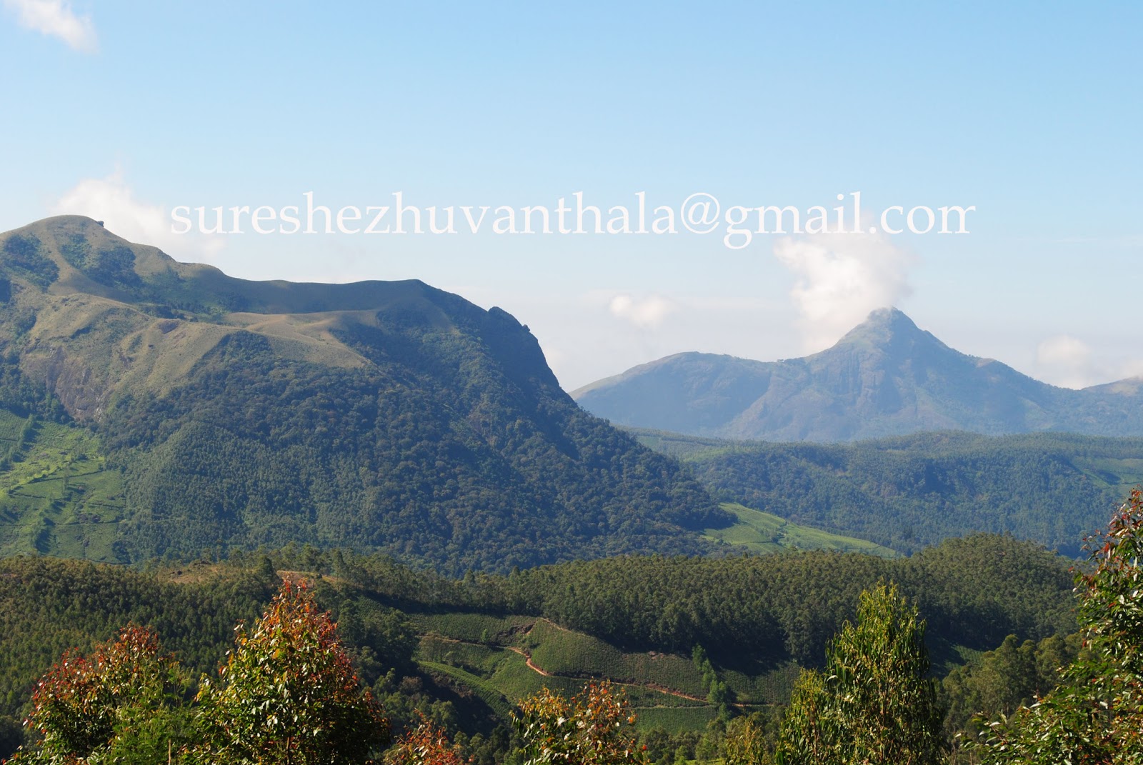
After crossing the 8 hills after base camp at Rhodo valley popular for Flowers which dot the landscape.From Rodovally right ,you reach Meesappulimala.The left route through the medows,river and Rhododentron trees deeds you to Karappaswami Kovil.There you can bath in below 15 Degee water.The trek to final reaches of summit is really challenging.The views of distant peaks..Anaimudi,tea gardens,Back waters of Anaiyiral are feast to the eyes.
.JPG)
+copy.jpg) |
| Rhodo vally Pond |
.JPG)
.JPG) |
| way to meesappulimala |

 |
| Meesappulimala |
 |
| Meesappulimala trekking |
 |
| Meesappulimala trekking |
 |
| Hamza,Dr Rahman,Shamon,Rasheed,Me,Mon,Saleem |
.JPG) | |
| On the way to Meesappulimala base camp,see Dr Rahman,Renjith,Ajith,Purush,Razaq,Basheer,Muhammed ali,Shino jacob |
.jpg)
.jpg)
.jpg)
.jpg)
.JPG)

.JPG)
.jpg) |
| way to Karappaswami kovil |

+copy.jpg)

+copy.jpg)
+copy.jpg)
+copy.jpg)
.jpg)
.jpg)
.jpg)
.jpg)
.jpg)
.jpg)
.jpg)
+copy.jpg)

.JPG)
+copy.jpg)
+copy.jpg)
.jpg)
.jpg)
+copy.jpg)


.JPG)
.jpg)
.jpg)
.jpg)
.JPG)
.jpg)
.jpg)
+copy.jpg)


.jpg)